


Mapping the world: locating the continents


Lesson details
Learning outcome
I can understand that a map is a 2D model of the world and I know what continents and oceans are.
Key learning points
- It is hard to make a 2D map of a 3D world and so maps of the world can look quite different from each other.
- We call large blocks of land continents and there are seven of these on Earth.
- There are seven continents: Europe, Africa, North America, South America, Asia, Oceania and Antarctica.
- Some continents, such as North and South America, are connected and some, such as Oceania, include lots of islands.
Keywords
2D - A two-dimensional (2D) object is flat - its dimensions are height (top to bottom) and width (side to side).
3D - A three-dimensional (3D) object is solid - its dimensions are height (top to bottom), width (side to side) and depth (front to back).
Continent - A continent is a large land mass on Earth and there are seven: Africa, Antarctica, Asia, Europe, North America, South America, Oceania.
Ocean - An ocean is a very big area of salt water between the continents.
Common misconception
Africa is country.
The continent of Africa contains 54 countries.
Teacher tip
You can use atlases or globes to explore the continents in different perspectives and think about the difference between 2D maps and 3D globes.

Equipment
Atlases, maps and globes.

Licence

Lesson video
Loading...
Prior knowledge starter quiz
6 Questions
Q1.Is this a 3D map or a 2D map?
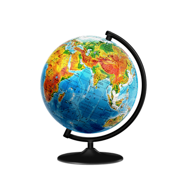
Q2.What is the name of the planet we live on?
Q3.What colour is water on maps usually represented as?
Q4.Land can be represented as which colours on a globe?
Q5.How many blocks of land can the land on Earth be divided into?
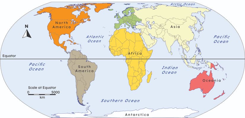
Q6.How many oceans are the waters on Earth divided into?
Assessment exit quiz
6 Questions
Q1.Can you match the key word to it's correct definition?

Q2.What is the air above Earth's surface called?
Q3.How many oceans are there on Earth?
Q4.What are large blocks of land on Earth called?

Q5.What are the names of the seven continents?
Q6.Which continent is furthest south?
To help you plan your 1 geography lesson on: Mapping the world: locating the continents, download all teaching resources for free and adapt to suit your pupils' needs...
To help you plan your 1 geography lesson on: Mapping the world: locating the continents, download all teaching resources for free and adapt to suit your pupils' needs.
The starter quiz will activate and check your pupils' prior knowledge, with versions available both with and without answers in PDF format.
We use learning cycles to break down learning into key concepts or ideas linked to the learning outcome. Each learning cycle features explanations with checks for understanding and practice tasks with feedback. All of this is found in our slide decks, ready for you to download and edit. The practice tasks are also available as printable worksheets and some lessons have additional materials with extra material you might need for teaching the lesson.
The assessment exit quiz will test your pupils' understanding of the key learning points.
Our video is a tool for planning, showing how other teachers might teach the lesson, offering helpful tips, modelled explanations and inspiration for your own delivery in the classroom. Plus, you can set it as homework or revision for pupils and keep their learning on track by sharing an online pupil version of this lesson.
Explore more key stage 1 geography lessons from the Continents and oceans: what can we find out about the world? unit, dive into the full primary geography curriculum, or learn more about lesson planning.