


Geographical skills: Describing the UK


Lesson details
Learning outcome
I can use maps and geographical skills to investigate the geography of the UK.
Key learning points
- The UK has a range of landscapes, settlement types, land uses and industries.
- We can use maps and other data sources to investigate differences in life across the UK.
- We can use geographical skills to investigate differences across the UK.
Keywords
Land use - Land use is the function or purpose of a particular area.
Industry - Industry is the business of turning raw materials into finished products usually in factories.
Population density - Population density is the number of people living in a defined area, e.g. 300 people per square kilometre.
Diversity - Diversity is the variety of human, physical or cultural characteristics in a geographical area.
Common misconception
Some learners may be less confident with the use of aerial images, maps and data.
Spend additional time recapping and consolidating learners' geographical skills in using maps and other sources of information.
Teacher tip
Learners could work together to create a whole-class display or assembly that celebrates their geographical learning about the UK.

Equipment
Scissors; large pieces of paper; photographs, maps and information books about the UK

Licence

Lesson video
Loading...
Prior knowledge starter quiz
6 Questions
Q1.What are the countries that make up the UK?
Q2.Different types of land use include...
Q3.The number of people living in a defined area (e.g. 300 people per square kilometre) is called...
Q4.Physical features are ...
Q5.Tourism, mining, farming, building are types of...
Q6.Diversity means...
Assessment exit quiz
6 Questions
Q1.A set idea that someone might have about a place or thing, which is often not true in reality is called a...
Q2.This is a...
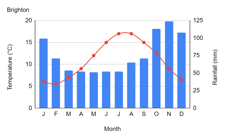
Q3.What sources can we use to investigate geographical differences across the UK?
Q4.Match the words with their definitions

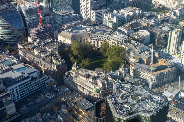
Q5.What type of photograph is this?
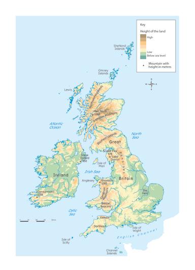
Q6.A relief map like this shows
To help you plan your 6 geography lesson on: Geographical skills: Describing the UK, download all teaching resources for free and adapt to suit your pupils' needs...
To help you plan your 6 geography lesson on: Geographical skills: Describing the UK, download all teaching resources for free and adapt to suit your pupils' needs.
The starter quiz will activate and check your pupils' prior knowledge, with versions available both with and without answers in PDF format.
We use learning cycles to break down learning into key concepts or ideas linked to the learning outcome. Each learning cycle features explanations with checks for understanding and practice tasks with feedback. All of this is found in our slide decks, ready for you to download and edit. The practice tasks are also available as printable worksheets and some lessons have additional materials with extra material you might need for teaching the lesson.
The assessment exit quiz will test your pupils' understanding of the key learning points.
Our video is a tool for planning, showing how other teachers might teach the lesson, offering helpful tips, modelled explanations and inspiration for your own delivery in the classroom. Plus, you can set it as homework or revision for pupils and keep their learning on track by sharing an online pupil version of this lesson.
Explore more key stage 2 geography lessons from the Around the world in 80 days: what have we learnt about our world? unit, dive into the full primary geography curriculum, or learn more about lesson planning.