Geographical skills: Describing the UK
I can use maps and geographical skills to investigate the geography of the UK.


- Year 6
Geographical skills: Describing the UK
I can use maps and geographical skills to investigate the geography of the UK.
Lesson details
Key learning points
- The UK has a range of landscapes, settlement types, land uses and industries.
- We can use maps and other data sources to investigate differences in life across the UK.
- We can use geographical skills to investigate differences across the UK.
Keywords
Land use - Land use is the function or purpose of a particular area.
Industry - Industry is the business of turning raw materials into finished products usually in factories.
Population density - Population density is the number of people living in a defined area, e.g. 300 people per square kilometre.
Diversity - Diversity is the variety of human, physical or cultural characteristics in a geographical area.
Common misconception
Some learners may be less confident with the use of aerial images, maps and data.
Spend additional time recapping and consolidating learners' geographical skills in using maps and other sources of information.


Equipment
Scissors; large pieces of paper; photographs, maps and information books about the UK

Licence
Lesson video
Loading...
Prior knowledge starter quiz
6 Questions
Q1.What are the countries that make up the UK?
Q2.Different types of land use include...
Q3.The number of people living in a defined area (e.g. 300 people per square kilometre) is called...
Q4.Physical features are ...
Q5.Tourism, mining, farming, building are types of...
Q6.Diversity means...
Assessment exit quiz
6 Questions
Q1.A set idea that someone might have about a place or thing, which is often not true in reality is called a...
Q2.This is a...
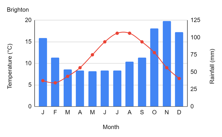
Q3.What sources can we use to investigate geographical differences across the UK?
Q4.Match the words with their definitions

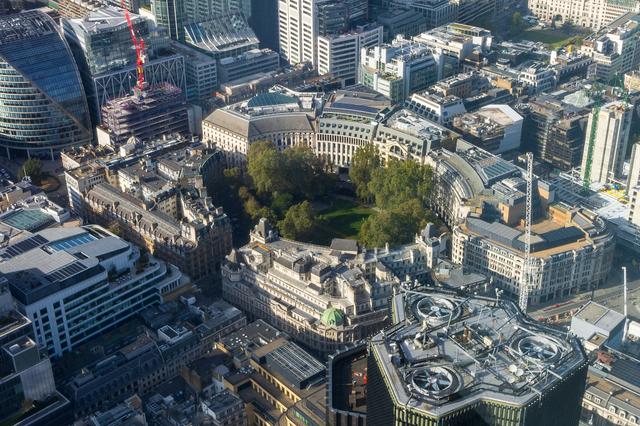
Q5.What type of photograph is this?
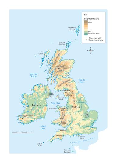
Q6.A relief map like this shows