


Our local area


Lesson details
Learning outcome
I can talk about the area where you live and find some familiar features on an aerial photograph or large-scale plan.
Key learning points
- Most local areas include geographical features such as houses, shops, places of worship and green spaces.
- Digital maps can switch from aerial to map view to help identify the familiar features of the local area.
- Locational language, maps, aerial images and fieldwork are used to identify and locate features in the local area.
Keywords
Local area - The local area is the space immediately around where you are.
Village - A village is a small group of houses where people live.
Town - A town is a settlement that is usually larger than a village but smaller than a city and generally has local government.
City - A city is a settlement that is usually larger than a town and has local government.
Aerial photograph - An aerial photograph is a picture of an object or place that has been taken from above.
Common misconception
Cities and towns are words used to describe a settlement of the same size interchangeably.
Towns are used to describe settlements with a population of thousands whereas cities are usually used to describe settlements of over 100 000 or millions.
Teacher tip
This is a local area study so you can replace the aerial photograph or maps with those from your local area.

Licence

Lesson video
Loading...
Prior knowledge starter quiz
6 Questions
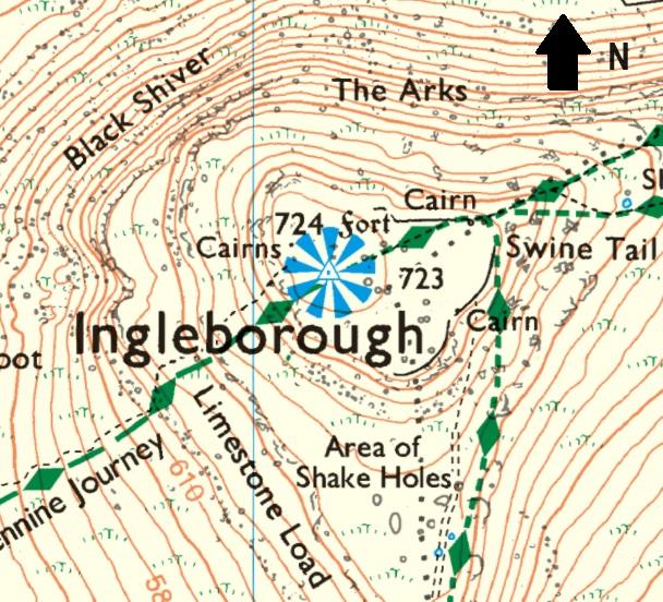
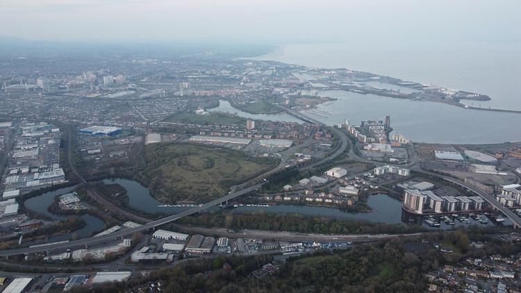
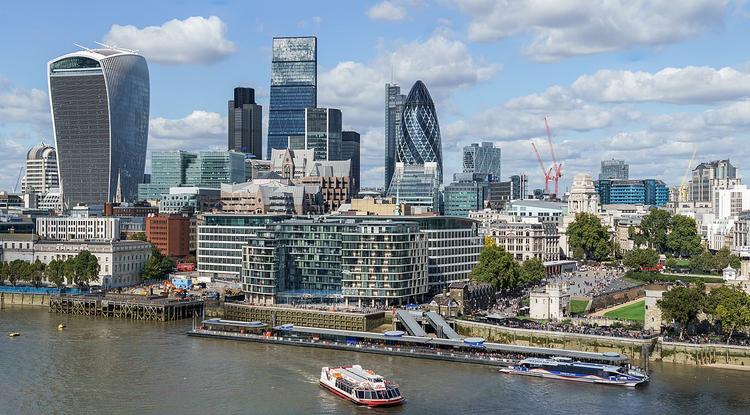
Q1.Which of these is an aerial photograph?

Q2.Why might a geographer add labels to an image/map?
Q3.Geographers can use maps to __________ things. Order these letters to find the missing word.
Q4.Which locational language could you use to complete this sentence? My house is __________ the park.
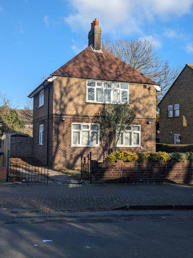
Q5.What type of house is this?
Q6.What information does an aerial photograph show us about a house?
Assessment exit quiz
6 Questions
Q1.Put these settlements in order of size, starting with the smallest.
Q2.Which of these would you be likely to find in a village?
Q3.Your local area is...
Q4.Which features might you find in your local area?
Q5.How is information displayed on large scale plans?
Q6.Why are digital maps useful?
To help you plan your 1 geography lesson on: Our local area, download all teaching resources for free and adapt to suit your pupils' needs...
To help you plan your 1 geography lesson on: Our local area, download all teaching resources for free and adapt to suit your pupils' needs.
The starter quiz will activate and check your pupils' prior knowledge, with versions available both with and without answers in PDF format.
We use learning cycles to break down learning into key concepts or ideas linked to the learning outcome. Each learning cycle features explanations with checks for understanding and practice tasks with feedback. All of this is found in our slide decks, ready for you to download and edit. The practice tasks are also available as printable worksheets and some lessons have additional materials with extra material you might need for teaching the lesson.
The assessment exit quiz will test your pupils' understanding of the key learning points.
Our video is a tool for planning, showing how other teachers might teach the lesson, offering helpful tips, modelled explanations and inspiration for your own delivery in the classroom. Plus, you can set it as homework or revision for pupils and keep their learning on track by sharing an online pupil version of this lesson.
Explore more key stage 1 geography lessons from the Local area: where do we live? unit, dive into the full primary geography curriculum, or learn more about lesson planning.